Showing posts with label Geography. Show all posts

April 6, 2015

Geography Tools

One of the Social Studies expectations for first graders in DC is to interpret the use of map elements to organize information about places and environment. Last year, the kiddos explored various map tools, including globes and atlases, and we had a discussion about their similarities and differences (see post).  This year, I did the same activity but created a worksheet to let the kiddos make their own observations.


I set out each of the tools on a table around the room and divided the kiddos into groups. They travelled around the room with their graphic organizers filling in each column as they explored each tool.  They did such a great job!


Grab this graphic organizer here for FREE!

March 17, 2014

Exploring Our World

 Back in January, we had a our annual Museum Exhibit Night (Read about previous Museum Nights here and here).  This year, the theme of our first grade exhibit was "Exploring Our World."  Through this theme, we incorporated our geography standards, field studies, and nonfiction reading unit.

Similar to last year, we created a map of the world on our shared bulletin board.  (Although this year I learned that I could use my SMART board projector to trace on to paper, making the continents much more to scale).  The kiddos labeled important geographical features, including oceans and mountain ranges.  Our sweet Art Teacher worked with each class to create 3D landmarks and topographies.


Unfortunately I forgot to take a picture of the whole exhibit so these close-ups will have to do!


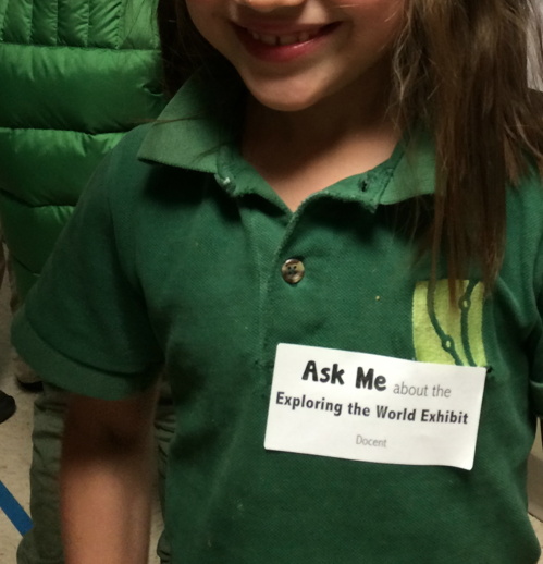
On the night of the exhibit, the kiddos got their "docent tags."  They loved hosting their friends and families around the exhibit, pointing out their details on the map and their book club posters. We managed to pull in a number of standards and skills with this project and it was obvious with all of the connections that the kiddos made as they talked about what they'd learned!


January 28, 2014

Tools of Travel

This week we are exploring maps -- and globes and atlases!  

The first grade geography standards for the DC Public Schools include "Locate the cardinal directions and apply them to maps and globes," "Locate Washington, DC on a map," and "Label the continents, oceans, and major mountain ranges on a map."  Although there are many aspects of this unit that require direct instruction, I wanted to be sure to include some interactive learning as well.  Investigating the differences between map tools was a perfect way to incorporate some hands-on work.  

I set out a globe, world and U.S. atlases, and a few maps of DC on tables around the room and the kiddos set out to make some observations.  Yep, they are wearing their jackets inside.  The heater in my classroom has been having some issues so the temp was in the 50s for much of the day, but that didn't stop these scholars! :)
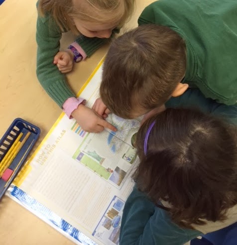
The kiddos cycled around the tables for about 15 minutes.  When we came back together we filled out a chart with our reflections.  The kiddos made some great observations!  They quickly noticed that the globe only labeled countries, that the maps showed details such as streets and businesses, and that the atlas had many maps, as well as information about certain places.  We concluded our discussion by considering why one might select a map versus a globe versus an atlas.  I came up with some potential scenarios and the kiddos put up their fingers to indicate the best tools (1=globe, 2=map, 3=atlas).  For instance, "I want to walk from my house to the library" (2), or "I wonder what Brazil is like" (3), or "I want to know how far it is from Washington, DC to Japan" (1). I have to admit that in my head the answer to all of them was "Google," but the kiddos got the idea. :)


Another great tool for teaching about maps (or anything else) is BrainPOP Jr. -- we watched "Reading Maps" as a review of our basic map skills and and introduction to the next bend in our unit: world geography.

January 27, 2014

Maps of the Classroom

I began our current social studies unit by reading Me on the Map, by Joan Sweeney.  Last year the Kindergarten classes had a whole unit based on this book, so most of my kiddos were familiar with it; nevertheless it's such a great introduction to maps and geography that I didn't mind repeating it (and the kiddos didn't either).  Specifically, it's a perfect reminder about how our community and country fit into the world.  

After reading the book, we discussed how maps can be useful to see landmarks, distance, and important features.  I also introduced some geography vocabulary words, such as key, legend, compass rose, cardinal directions, and scale, using the book We Need Directions, a Rookie Read-About Geography book.  (There are a bunch of these little books that cover a variety of geography topics -- so helpful!) Then, we created individual classroom maps.  We talked about why we might need a map of the classroom, for instance if we got a new student, had a substitute teacher, or invited our families to visit, they might use the map to find our pencil sharpener or computers.  Firsties often struggle to show objects from the birds-eye perspective so their maps can be quite interesting; nevertheless, they love adding their table, cubbies, shelves, and other classroom features.  

Their maps turned out so well!