January 28, 2014

Tools of Travel

This week we are exploring maps -- and globes and atlases!  

The first grade geography standards for the DC Public Schools include "Locate the cardinal directions and apply them to maps and globes," "Locate Washington, DC on a map," and "Label the continents, oceans, and major mountain ranges on a map."  Although there are many aspects of this unit that require direct instruction, I wanted to be sure to include some interactive learning as well.  Investigating the differences between map tools was a perfect way to incorporate some hands-on work.  

I set out a globe, world and U.S. atlases, and a few maps of DC on tables around the room and the kiddos set out to make some observations.  Yep, they are wearing their jackets inside.  The heater in my classroom has been having some issues so the temp was in the 50s for much of the day, but that didn't stop these scholars! :)
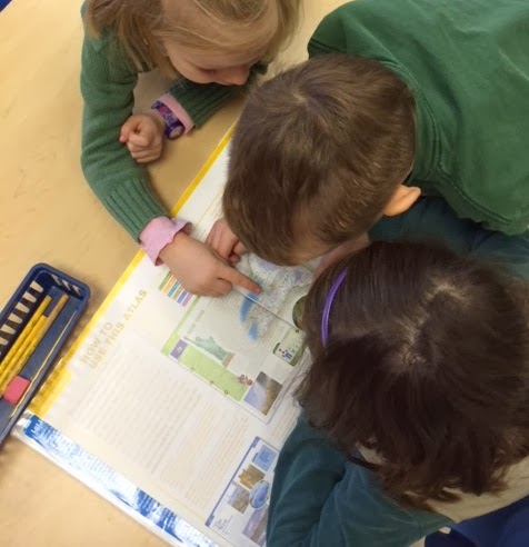
The kiddos cycled around the tables for about 15 minutes.  When we came back together we filled out a chart with our reflections.  The kiddos made some great observations!  They quickly noticed that the globe only labeled countries, that the maps showed details such as streets and businesses, and that the atlas had many maps, as well as information about certain places.  We concluded our discussion by considering why one might select a map versus a globe versus an atlas.  I came up with some potential scenarios and the kiddos put up their fingers to indicate the best tools (1=globe, 2=map, 3=atlas).  For instance, "I want to walk from my house to the library" (2), or "I wonder what Brazil is like" (3), or "I want to know how far it is from Washington, DC to Japan" (1). I have to admit that in my head the answer to all of them was "Google," but the kiddos got the idea. :)


Another great tool for teaching about maps (or anything else) is BrainPOP Jr. -- we watched "Reading Maps" as a review of our basic map skills and and introduction to the next bend in our unit: world geography.

January 27, 2014

Maps of the Classroom

I began our current social studies unit by reading Me on the Map, by Joan Sweeney.  Last year the Kindergarten classes had a whole unit based on this book, so most of my kiddos were familiar with it; nevertheless it's such a great introduction to maps and geography that I didn't mind repeating it (and the kiddos didn't either).  Specifically, it's a perfect reminder about how our community and country fit into the world.  

After reading the book, we discussed how maps can be useful to see landmarks, distance, and important features.  I also introduced some geography vocabulary words, such as key, legend, compass rose, cardinal directions, and scale, using the book We Need Directions, a Rookie Read-About Geography book.  (There are a bunch of these little books that cover a variety of geography topics -- so helpful!) Then, we created individual classroom maps.  We talked about why we might need a map of the classroom, for instance if we got a new student, had a substitute teacher, or invited our families to visit, they might use the map to find our pencil sharpener or computers.  Firsties often struggle to show objects from the birds-eye perspective so their maps can be quite interesting; nevertheless, they love adding their table, cubbies, shelves, and other classroom features.  

Their maps turned out so well! 


January 23, 2014

Reading Nonfiction

We are now in the 3rd week of our nonfiction reading unit.  For the first part of the year, our classroom library had a few fiction book bins, organized by author or theme, and a few popular nonfiction bins, such as "plants" and "how-to."  During our nonfiction unit, though, the whole library becomes dedicated to nonfiction.  Last year, I did the work of turning over our library and organizing the book bins.  This year, I really wanted to get the kids in on the action.


On the first day of the unit I pulled out a box of about 75 nonfiction books on a variety of topics.  I explained to my eager readers that I had found all of these nonfiction books in the closet (no lie) and needed their help to organize them.  We talked about how we could sort the books like librarians do: by author, by level,  by type (chapter books, picture books), or by topic.  We decided that sorting by topic made the most sense for nonfiction books, so I set a pile of books on each table and let them go to work!

The kiddos did a great job with this task, quickly making piles of animal books, bird books, insect books, plant books, and ocean creature books.  Then the kiddos came to group of books that presented a slight challenge.  They created a "dangerous things" pile (which included books on earthquakes, volcanos, twisters, and storms), a "weather" pile, and still had a few books on fossils and caves left over.  I knew that all of these books were actually part of an "earth science" set, but the kiddos insisted that they didn't all go together.  I began to push them to keep the set together, but then realized that their way made perfect sense too.  Instead, I taught them the term "natural disasters" for all of the "dangerous" topics, and we put the rest into a "weather and nature" bin. Problem solved!


I did have to gather up a few extra bins to accommodate all of our topics, but it was worth it to see how invested the kiddos have become in our library!  After we had all of our piles, I handed out some index cards and had the kiddos create labels for the bins.  They've been so excited to actually read the books they had put in the bins, and they're being very responsible about putting books back where they belong.