This week we are exploring maps -- and globes and atlases!
The first grade geography standards for the DC Public Schools include "Locate the cardinal directions and apply them to maps and globes," "Locate Washington, DC on a map," and "Label the continents, oceans, and major mountain ranges on a map." Although there are many aspects of this unit that require direct instruction, I wanted to be sure to include some interactive learning as well. Investigating the differences between map tools was a perfect way to incorporate some hands-on work.
 I set out a globe, world and U.S. atlases, and a few maps of DC on tables around the room and the kiddos set out to make some observations. Yep, they are wearing their jackets inside. The heater in my classroom has been having some issues so the temp was in the 50s for much of the day, but that didn't stop these scholars! :)
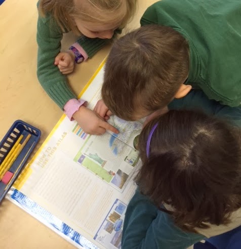

The kiddos cycled around the tables for about 15 minutes. When we came back together we filled out a chart with our reflections. The kiddos made some great observations! They quickly noticed that the globe only labeled countries, that the maps showed details such as streets and businesses, and that the atlas had many maps, as well as information about certain places. We concluded our discussion by considering why one might select a map versus a globe versus an atlas. I came up with some potential scenarios and the kiddos put up their fingers to indicate the best tools (1=globe, 2=map, 3=atlas). For instance, "I want to walk from my house to the library" (2), or "I wonder what Brazil is like" (3), or "I want to know how far it is from Washington, DC to Japan" (1). I have to admit that in my head the answer to all of them was "Google," but the kiddos got the idea. :)

Another great tool for teaching about maps (or anything else) is BrainPOP Jr. -- we watched "Reading Maps" as a review of our basic map skills and and introduction to the next bend in our unit: world geography.
No comments:
Post a Comment